
3. Spatial dimension
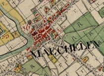
In setting up the infrastructure, the spatial component is important. The relevant statistics refer to localities whose relative position provides a suitable basis on which to put together very disparate data sets so as to study them comparatively. Within the framework of the STREAM project, a tailor-made spatio-temporal frame of reference will be developed that will permit comparative research in time and space. This frame of reference constitutes the project's backbone. It will permit the collection, collation, analysis and presentation of historical data. The geographical data files generated by STREAM are based on the basic maps for the area concerned. For the period under consideration, the Ferraris map (1770-1777) is the primary source. On the basis of the original copy from Vienna, this map is to be manually vectorized and then compared with current topographical maps so as to eliminate geometrical variations. Other large-scale maps can be added to the infrastructure in the future. In this way, a series can be created in order to reconstruct the landscape, housing, borders and transport infrastructure at a number of historical moments for the area concerned.
1. Purpose and objectives
2. Scope
3. Spatial dimension
4. Implementation
5. Data collections